Li et al. (2025), Arizona State University, Metis Center, Report No. ASU-METIS-25-TRS-001.

Overview
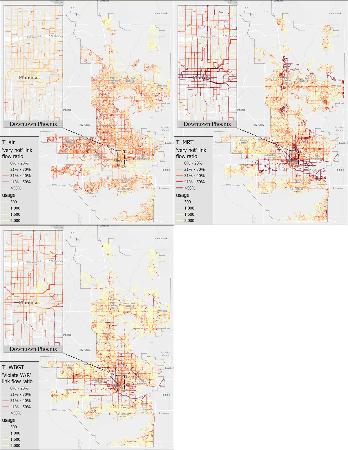
Source: Li et al. (2023), doi: 10.3389/frsc.2023.1129388
Icarus is a framework designed to assess individual's environment exposure as they undertake their daily activities including travel, indoor activities, and outdoor activities, and identify novel mitigation and adaptation solutions. The framework was developed to harness emerging and novel digital twin data and models including activity based travel models, environmental hazards (e.g., heat and air quality), and infrastructure.
Icarus has been used to describe novel framings of sub-population vulnerability to environmental hazards. The framework supports vulnerability assessment based on both external (vulnerability activities that exceed thresholds of risk) and internal (the identification of risky behavior of subpopulations relative to a large population) frames.
Harnessing high performance computing Icarus can assess entire populations and their daily activities to describe novel adaptation and mitigation strategies including built environment and travel behavior change to reduce vulnerability.
Contact
Contact Prof. Chester to use the models, or for additional information.
Documentation including publications are provided below.
Mikhail Chester
mchester@asu.edu
Framework
The Icarus framework builds an urban digital twin with a synthetic population and environmental hazard layers to assess the exposure of travelers and the conditions of travel and the built environment that can be modified to reduce exposure.
With a digital twin and synthetic population daily routing of the entire metro region's population is undertaken with a focus on active mobility travelers. This routing when joined with environmental hazards provides fine-scale (space and time) estimates of exposure and new insights into the particular travel behaviors and built environment characteristics that increase exposure. Icarus can then adjust routing and built environment characteristics to reduce exposure.
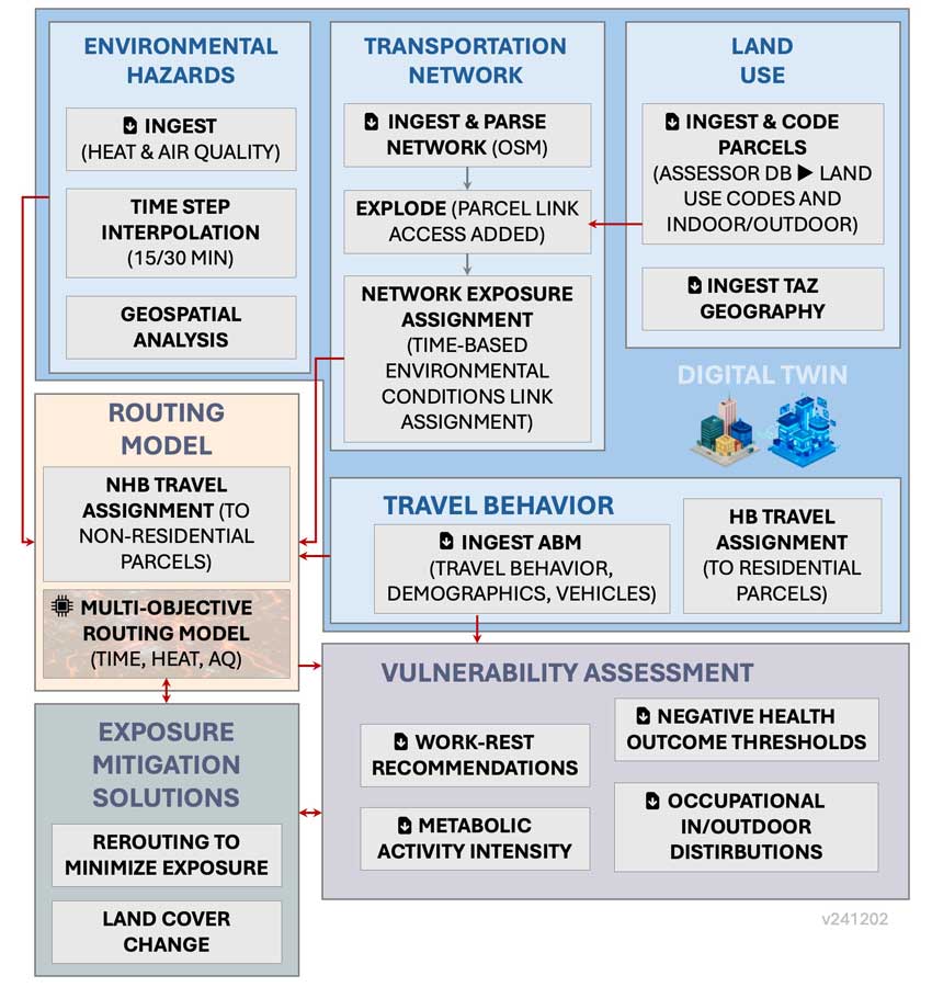
Digital Twin for Exposure Mitigation
The Icarus framework leverages a digital twin of a city that includes a synthetic population, land use and parcel characteristics, and transportation networks. Environmental hazards are introduced with variations across geography and time of day.

Environmental Hazards
The models can ingest environmental hazards at fine spatial and time scales. Air temperature, wet bulb globe temperature, mean radiant temperature, air pollution, and other hazards have been used for hazard assessment.
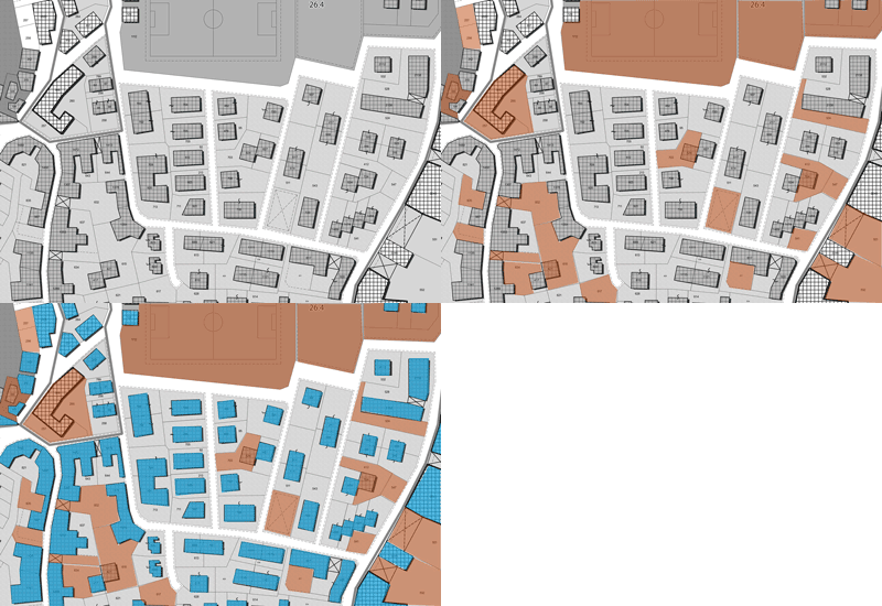
Buildings with AC.
Land Use
County assessor databases are used to specify buildings, parcels, and land use categories. Households are assigned home residences and are matched to non-home parcels during their daily travel. Parcels are coded as having air conditioning.

Transportation Networks
Open Street Maps layers are loaded including roadways, sidewalks, and transit to form the transportation networks. These networks are exploded when joined with building layers to capture precise indvidual routes. Network links are then joined with environmental hazards to produce a time-based network exposure assignment.


